LectureOnlineHeld
Geoinformatics Approaches to Understanding and Managing the Dust Crisis from Local to Regional Scales
- 04:00 PM
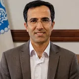 Ali Darvishi Boloorani
About this event
The webinar "Geoinformatics Approaches to Understanding and Managing the Dust Crisis from Local to Regional Scales" is held with the aim of examining the role of spatial data, remote sensing, and geoinformatics technologies in studying the dust phenomenon.
In this session, Dr. Ali Darvishi Bolourani, Professor of Remote Sensing (Geoinformatics) at the Faculty of Geography, University of Tehran, will speak about modern methods for identifying dust source areas, monitoring environmental changes, and the capacities of spatial technologies for managing this environmental crisis.
This webinar is an opportunity for researchers, students, and enthusiasts in the fields of geography, remote sensing, environmental sciences, climate change, and crisis management to become acquainted with scientific and applied approaches to confronting one of the region's major environmental challenges.
This program, as the 13th scientific webinar of the Specialized Committee on Climate Change, will be held online on Saturday, August 29, 2026, at 4:00 PM.
Contact channels:
Channel: Bale (https://ble.ir/ircold_climatechange) | Telegram (https://t.me/IRCOLD_ClimateChange) Group: Bale (https://ble.ir/IRCOLD_Climate_Change) | Telegram (https://t.me/IRCOLD_Climate_Change)
It is advisable to join both Bale and Telegram platforms to ensure timely follow-up of all announcements.
Speaker
How do I attend?
- Attendance is arranged by the organiser of this event.
- Put the time in your calendar so it doesn't slip by.